


Washington: They spend most of their time analyzing maps for buried bombs in Afghanistan and Iraq or looking at what turned out to Osama bin Laden’s last residence, but intelligence analysts sometimes help out on the home front as well.
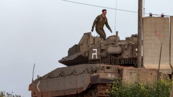
As Hurricane Irene sends the East Coast scrambling to find shelter, clear out its drains and to endlessly watch the Weather Channel, the National Geospatial Intelligence Agency has readied special teams and vehicles called DMIGS to plan for and assist after the storm rolls north.
“Analysts are staged and ready to go, and the DMIGS is standing by to support urban search and rescue efforts,” NGA spokeswoman Sue Meisner said in an email. The intelligence agency isn’t sure where the teams will be sent yet because the storm’s course is still uncertain. Locations are to be determined.
DMIGS stands for Domestic Mobile Integrated Geospatial-Intelligence System. These truck-borne units were used after Hurricane Katrina to great effect, though relatively few people outside the National Guard and other first response units knew much about them. General Dynamics developed the equipment to go in the trucks.
One of the intelligence community‘s operators most familiar with DMIGS and other NGA capabilities is now the Director of National Intelligence, Jim Clapper. He ran NGA during Hurricane Katrina.
Keith Masback worked for Clapper at NGA, where he was director of NGA’s Source Operations Group during Katrina. Now the head of the U.S. Geospatial Intelligence Foundation, Masback was responsible for deciding how to use and where to point the nation’s highly classified spy satellites, as well as their commercial counterparts. On top of that, Masback worked closely with Northern Command and the senior military leadership on how to deploy sensor-laden planes and helicopters to get even more information after the satellites had given them a good idea where to look and what to look for.
Before Katrina hit, he says NGA was able to, “pre-position mobile support teams and equipment, obtain pre-landfall baseline imagery for analysis and development of various mapping and charting products, and ultimately provide superb support to everyone from federal officials to search and rescue teams on the ground.”
A report for the Bush White House, “The Federal Response to Hurricane Katrina: Lessons Learned,” backs him up, praising two federal agencies most highly for their work during Katrina, the Coast Guard and NGA.
What NGA did then is worth reading as a blueprint for a baseline look at how the intelligence agency is likely to respond this time. The agency collected information about key sites — airports, hospitals, police stations, emergency operations centers, highways and schools — “well in advance of landfall and got this information into the hands of Federal, State, and local first responders in the affected region,” the White House report notes. “Because they had assets in place and focused on the region, NGA provided the first comprehensive overview of the damage resulting from the hurricane and flood. NGA merged imagery with other information, creating hundreds of intelligence products per day that could be used and applied by response professionals to aid in decision-making. NGA assessments were multi-dimensional, timely, relevant, and continuous.”
After Katrina, Masback and colleagues at the Department of Homeland Security put together a domestic disaster wargame to figure out how to improve the intelligence community’s responses. “The result was the creation of the Interagency Remote Sensing Coordination Cell (IRSCC) which helps bring together the various entities responsible for providing this support and making sure that it is more tightly coordinated to be moreeffective and efficient,” notes Masback.
Among the key assets NGA draws on are spy satellites operated by the National Reconnaissance Office. Known in the intelligence community as National Technical Means (usually spoken in hushed tones if reporters are around). An NGA fact sheet on hurricane response notes that one of they key contributions NTM can make to disaster response is, “the ability to rapidly acquire images of broad areas at high resolution.” This highly classified information is well scrubbed before being released to the public. Because scrubbing the information slows down its release, NGA also relies heavily on two commercial companies that provide similar but degraded capabilities. [Editor’s note: The photo split shows before and after images taken by GeoEye of damage inflicted on Japan by the tsunami.]
The former senior intelligence official offered high praise to the two main commercial imagery companies, DigitalGlobe and GeoEye, who, he said, “have routinely proven themselves to be superb citizens when it has come to rapidly providing their imagery and analytic products to people in need.” The two companies gave away their products to the general public as soon as it was available.
For those citizens who worry about the intelligence community operating within U.S. borders, Masback says his, “personal experience is that there are clearly defined legal and policy processes that are applied day in and day out which provide for the absolute protection of the American people, while allowing for these systems to be used to save lives and property.”
The regular military, with whom the intelligence community works day in and day out, is deploying. The Pentagon announced in a late Friday afternoon statement that it has “already prepositioned 225 non-DoD trucks loaded with equipment, food, water, and generators” at Fort Bragg, NC. On top of that, 18 helicopters are deploying to the Northeast “to be ready to provide critical life saving and life sustaining support should it be needed. These aircraft are being pre-positioned close enough to render swift assistance, but out of the way of Irene’s path. Eight helicopters are deploying from Fort Stewart, Ga., to Fort Drum, N.Y. An additional 10 helicopters are afloat on the USS Wasp, an amphibious assault ship out of Norfolk, Va. As with many ships in the path of the storm, the USS Wasp has moved out to sea and out of Irene’s way. It will follow in behind the storm and be ready to render assistance as required.”
In addition, some 101,000 National Guard are on call by the governors of the affected areas, the statement says.

ROC-X – The solution to organic precision strike capabilities
At AUSA Global Force 2024, IAI will present integrated, AI-driven combat systems – both manned and unmanned – that are opening new opportunities on the battlefield.

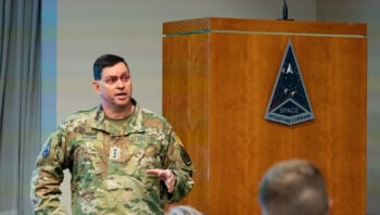
China’s new H-20 stealth bomber ‘not really’ a concern for Pentagon, says intel official
“The thing with the H-20 is when you actually look at the system design, it’s probably nowhere near as good as US LO [low observable] platforms, particularly more advanced ones that we have coming down,” said a DoD intelligence official.