


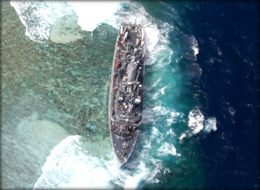
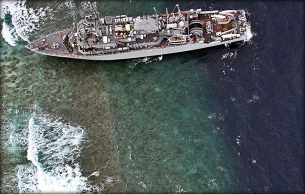
USS Guardian lies crippled on UNESCO World Heritage Tubbataha Reef in the Philippines
WASHINGTON: The January grounding of the minesweeper USS Guardian in a Philippine coral reef was caused in large part by a National Geospatial Intelligence Agency (NGA) map that was, quite simply, wrong by eight nautical miles, Breaking Defense has learned.
“It really was just a terrible fluke that caused the error,” NGA spokeswoman Christine Phillips said in a frank discussion of the incident and its aftermath.
The Sulu Sea grounding prompted NGA to order an agency-wide review of the nautical charts detailing the entire surface of the earth covered by the oceans. Also, NGA and the Navy have convened a team of maritime experts to take “an exhaustive look to make sure we are as sound as we can be,” Phillips told me.
The error boiled down to someone at NGA failing to update a map with corrected data after cartographers discovered an inaccuracy.
Here’s what happened. “Prior to 2008, charts in that area included many ‘phantom’ reefs and islands — legacies of old maps and data. In response to customer requests to remove these, NGA used LANDSAT-derived commercial imagery to update the charts,” Phillips said, noting the commercial data was the only information source available for that area. The Landsat data was wrong.
“In 2011, we obtained survey data that corrected this error, and two of the three charts that included it were updated. Procedures in effect at the time should have caused the third to be fixed, as well.” But one map, the Coastal Scale — was not updated due to “human error.” And that was the map the Guardian’s crew relied on.
Tragically, the two other maps to which the crew had access — but did not use — presented the correct information, Phillips said.
At the time of the grounding, environmentalists criticized the US Navy for damaging Tubbataha Reef, a UNESCO World Heritage Site. Those opposed to America’s close relationship with the Philippines pointed to the grounding and subsequent legal defense of the crew by the Philippine government as proof of the inequitable — dare one say neo-colonial — relationship between the two countries. And old salts wondered just what the hell the ship’s captain had done.
The Navy noted that the charts were a prime cause of the the problem in its report but did not explain what went wrong. Here’s the official Navy summary of the 160-page report on the Guardian’s grounding: “This tragic mishap was wholly preventable and was the product of poor voyage planning, poor execution, and unfortunate circumstances. This investigation uncovers no single point of failure; instead, there were numerous links in the error chain leading up to the grounding.”
The absence of a clear explanation prompted a recent article by a retired Phillpine commodore in which he raised questions about the grounding. The Navy report, noted Rex Robles in an article for a Philippine TV station, said the report appeared “superficial and incomplete” because “it failed to attach true copies of essential navigational documents.”
The report does make clear the role the charts and the commanders played in the grounding.
“The cause of the grounding was the failure to reconcile the known difference between DNC® GEN11A, the ‘general’ chart, and DNC® COA11D, the ‘coastal’ chart,” the report states.
USS Guardian grounded in this position. Strong waves later shoved ship sideways.
If the top three officers had executed their duties correctly once they knew “there was a difference between the ‘general’ chart and the ‘coastal’ chart,” the report says “the grounding would not have occurred.”
Charts from NGA are usually highly reliable, built as they are with satellite information gathered by the intelligence agency, coastal surveys by the US and other governments, with all of it supplemented by data gathered by NGA’s World-Wide Navigation Warning Service Broadcast Desk. The last time a significant mapping error caused an international incident was in 1999, when the United States bombed China’s embassy in Belgrade, Serbia during the war, killing three people. Some foreign news accounts reported that the strike was deliberate, but US officials have resolutely held to the line that a mapping error occured.
That’s why the agency’s reaction to this error has been so all-consuming: NGA maps matter. They matter to troops in Afghanistan and special operators around the world. They matter to ships around the world. They matter to policymakers, the intelligence community, and the White House.
The reef error was corrected within a week and that information distributed throughout the government, the NGA spokeswoman said. One other error — of roughly 7,000 yards — near Chile was found and corrected as well.
One of the Navy report’s recommendations was that its mariners who discover chart errors anywhere on the seven seas be required to notify NGA’s World-Wide Navigation Warning Service Broadcast Desk.
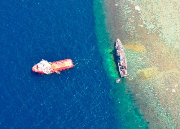
Clear view of damage to reef by USS Guardian
The other side of this story is that the US Navy has lost one of its comparatively rare assets for finding and destroying sea mines, one of the gravest — yet least prominent — threats to our interests in the Persian Gulf and Korean waters.

Future inevitability of quantum computers is a security problem today
‘Store Now, Decrypt Later’ attacks must be thwarted now with Zero Trust cybersecurity.
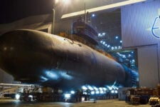
GD chief says Navy’s 1 sub buy won’t impact company short term, but out years less certain
The comments from the General Dynamics chief come on the same day President Joe Biden signed the national security supplemental, which includes billions for the sub industrial base.