


WASHINGTON: As FEMA, firemen, police and the National Guard wade into the devastation visited upon us by Hurricane Sandy, many of them are using maps and other information made available to them by intelligence agencies.
While intelligence analysts and their technical specialists usually spend their time targeting bad guys and helping troops plan to get them, some of them have gotten the rare and welcome chance to help their countrymen at home several times since Hurricane Katrina ravaged New Orleans.
The National Geospatial Intelligence Agency (NGA) provides most of the support to civil authorities during disasters. It takes photos, infrared and other data from satellites and airplanes and builds them into remarkably detailed and accurate maps. These maps help guide FEMA and local authorities to the worst-hit areas with high degrees of certainty, meaning they can be sent more quickly and deployed more efficiently than in the past. The maps also mean the police and firemen know what they are likely to encounter when they arrive on the scene, whether it’s simple flooding, damaged buildings and ruined or blocked roads.
Much of the satellite imagery comes from the National Reconnaissance Office’s highly classified spy satellites. Before Sandy struck on Monday, NGA embedded teams to work with the Federal Emergency Management Agency (FEMA) in New York, New Jersey, Pennsylvania and Virginia. They also worked with FEMA at its headquarters here. Also, the NRO may well be providing quiet support to the recovery effort.
“Currently, NGA’s support has included damage assessments of the affected areas to help FEMA and first responders manage their response levels effectively,” NGA spokeswoman Reishia Kelsey said in an email to Breaking Defense.
NGA is also helping FEMA with a “fully-enabled web site” that offers federal authorities, police and firemen “controlled access” to satellite imagery, easily manipulated map data and other information.
To get information as close to the action as can be done, NGA makes sure it can be used on smartphones and tablets “even in areas experiencing intermittent or disconnected cell service connectivity as a result of the storm,” Kelsey wrote.
Kelsey and her NGA colleagues provided very few details, but when Hurricane Irene hit last year, NGA told us they deployed a truck-mounted system known as DMIGS (Domestic Mobile Integrated Geospatial-Intelligence System). These were first used after Hurricane Katrina to great effect, though relatively few people knew much about them. General Dynamics developed the equipment to go in the trucks.
For a look at just what NGA is likely to be doing, a White House report issued after Katrina provides a blueprint. The agency collected information about key sites — airports, hospitals, police stations, emergency operations centers, highways and schools — before the hurricane hit New Orleans and made sure the information got to federal, state, and local officials.
“NGA merged imagery with other information, creating hundreds of intelligence products per day that could be used and applied by response professionals to aid in decision-making. NGA assessments were multi-dimensional, timely, relevant, and continuous,” the report notes. We can be pretty sure they are doing the same things as I write.
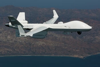
GA-ASI’s MQ-9B: The right UAV for persistence, power, and performance
When assessing the state of the art of unmanned aerial systems, it’s critical to be very clear about what various aircraft can and can’t do – and could never do.
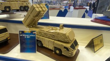
Iran says it shot down Israel’s attack. Here’s what air defense systems it might have used.
Tehran has been increasingly public about its air defense capabilities, including showing off models of systems at a recent international defense expo.