


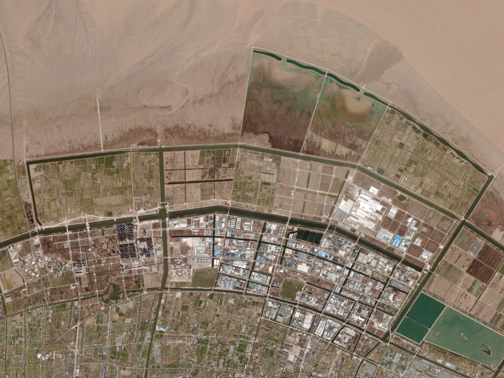
Hangzhou river in China, Planet image
WASHINGTON: The National Geospatial-Intelligence Agency (NGA) will announce plans in May to contract with commercial companies to for analyze satellite and other imagery data of military targets, says David Gauthier, head of NGA’s new(ish) Commercial and Business Operations Group.
While the first contracts will be small, the move is a big step toward the spy agency’s goal of creating a “hybrid” pool of data that combines commercial imagery with low-resolution but high re-revisit rates with traditional high-resolution that is less timely Intelligence Community imagery provided by the National Reconnaissance Office (NRO) and others.
“We do foresee in the future a hybrid architecture, where we definitely require both national systems for their capabilities, and commercial systems for their capabilities,” he said.
While Gauthier wouldn’t provide a budget for the new effort, he told me earlier this week that the plan is to evaluate the capabilities of a number of commercial companies to meet NGA’s needs.
“I don’t want to discuss numbers at this time, but we are still operating at small scale and plan on contracting with multiple vendors to compare and contrast their capabilities,” he said.
NGA does not intend to specify the sources used for the imagery analysis, he said. Instead, companies can choose whether to use data from satellites, airborne sensors, geolocation data or other sources to provide their analysis of activities at targeted facilities, such as North Korean rocket launch sites or Iranian nuclear reactors.
While imagery sources will not be mandated, Gauthier was enthusiastic about the potential of commercial synthetic aperture radar (SAR) satellite data to significantly beef up NGA’s analysis. Unlike electro-optical sensors, SAR can see both day and night, under all weather conditions.
“If they want to use SAR, that would be fantastic!” he said.
Until recent years, only the NRO and its ilk possessed SAR capabilities. Now, an increasing number of startups — both foreign and domestic — are launching SAR constellations.
As Breaking D readers know, the US for several years has been grappling with how to handle the proliferation of commercially available SAR imagery. It’s been an especially difficult issue because most of the imagery emanates from non-US providers, such as Finland’s ICEYE. In the US, there have been long-standing sales restrictions due to concerns about undercutting NRO’s technology edge. As I reported, the NRO in December awarded its first contract to US start-up Capella Space to study using commercial SAR imagery.
“As we look at Capella Space, their goal is a constellation of 36 satellites that provide the 15 minutes revisit — day, night and in bad weather — which is fantastic and would lend itself to great monitoring of those military installations we care about around the world,” Gauthier said.
However, he caveated, there are not yet many commercial SAR startups with satellites in orbit, so the promise of ubiquitous, near-real-time monitoring of adversary activities, including the ability to follow the movement of a single vehicle such as a mobile missile launcher, has yet to be fulfilled.
Since 2017, NRO — rather than NGA as in the past — has had the responsibility for contracting with commercial companies for satellite imagery, including SAR. NGA instead is now charged with buying imagery from other sources, such as from airborne sensors, or from providers of geolocation services that map a target’s whereabouts using radio frequency data. It also is charged with buying data analytics based on imagery and machine learning tools to augment the work of its own analysts.
For example, NGA has used startup Planet’s automated data process system that trains machine learning algorithms to identify terrestrial objects, such as ships at sea. (Planet was also contracted by NRO in 2019 to provide commercial imagery gathered by Planet’s Dove constellation of small satellites.)
Further, NGA increasingly is moving towards a reliance on commercial firms to gather geospatial intelligence (GEOINT). “Basically, if that’s where the bulk of the data is, then we will work where the data exists,” Gauthier told me.
NGA defines GEOINT as “the exploitation and analysis of imagery and geospatial information to describe, assess, and visually depict physical features and geographically referenced activities on the earth. Geospatial intelligence consists of imagery, imagery intelligence, and geospatial information.”
Up to now, however, NGA has been in an exploratory stage with contracting commercial companies, seeking to test their capabilities. Instead of tasking commercial firms to monitor high-value military targets, it has instead hired them to provide monitoring and insights about activities — or sometimes worked out a deal to get analysis for free — of commercial activities, such as a country’s oil storage facilities and illegal fisheries.
For example, it worked with Ursa Space Systems, which provides analysis based on SAR satellite data, to monitor oil storage facilities and undertake economic analysis based on activities at those sites, Gauthier said.
Gauthier said the new contracts will involve change analysis of selected military installations, including development of “baselines and reporting periodic status updates.” NGA will broadcast its intent to open bids in May, and will host an industry day in June or July, he said.
“I can’t give you exact budget numbers, but I can tell you that over the two-year period we’re going to scale up by about 20 times what we were doing in the evaluation period as far as how much we’re going to purchase for operations,” he said.

Future inevitability of quantum computers is a security problem today
‘Store Now, Decrypt Later’ attacks must be thwarted now with Zero Trust cybersecurity.

Air Force picks Anduril, General Atomics for next round of CCA work
The two vendors emerged successful from an original pool of five and are expected to carry their drone designs through a prototyping phase that will build and test aircraft.