


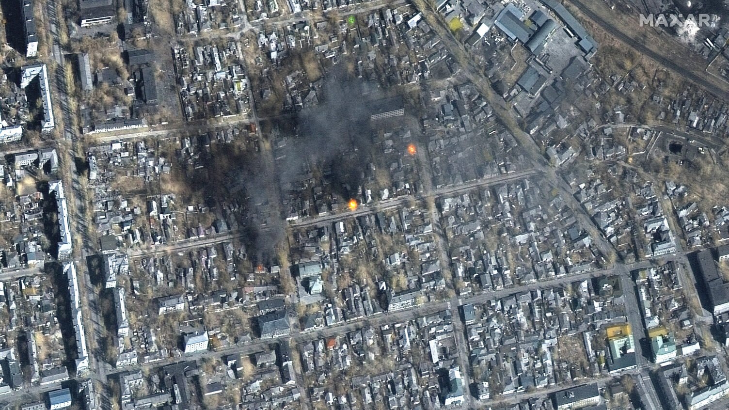
Satellite imagery taken by Maxar on March 14, 2022, shows damage in the southern Ukrainian city of Mariupol.
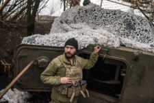
SPACE SYMPOSIUM: Russia’s war in Ukraine has shown the power of open-source geospatial information in pre-conflict and war, both for deterrence, actually prosecuting military operations and disproving false propaganda. It’s an information victory (so far) that US intelligence officials said they helped coordinate with private satellite firms that have provided prompt imagery to friendly nations, news organizations and the public.
But experts say that relationship also raises questions about what it could mean in a future conflict — whether with China, which is likely learning its own lessons about the information war from Russia’s failings, or a conflict in which the US government might not be so keen on satellite imagery being so readily accessible.
Of Ukraine, David Gauthier, director of commercial operations at the National Geospatial-Intelligence Agency, told reporters Wednesday it’s “actually surprising to see that information advantage on the battlefield is so far countering superior equipment and mass. That is just amazing to see as an intelligence professional.
“The power of information is winning,” he told a panel sponsored by commercial remote sensing firm Hawkeye 360 in the margins of the Space Foundation’s annual Space Symposium in Colorado Springs, Colo.
Gauthier revealed his team at NGA “started to facilitate and coordinate independent private efforts to directly provide their products and services to Ukraine” even before the conflict began. NGA assisted the flow commercial imagery — from companies like Planet, Maxar, BlackSky and Capella — not only to Ukraine, but to European Command and NATO, he said.
“I get on the phone with all our primes and say, here’s what’s going on. Here’s what you need to be aware of from a risk to your company [standpoint]. And here’s what we want you to put out, and to not put out. But you can do what you want,” he said. “And so far, you know, and they’re doing this. They’re very receptive to that kind of guidance.”
His remarks echoed those of Stacey Dixon, principal deputy director of national intelligence, here on Tuesday, who said the Intelligence Community had “asked a few commercial companies” to make imagery of what Russia was doing both in the run up to its invasion of Ukraine and during the war “rapidly available.”
In the Ukraine test, Gauthier explained, NGA is essentially using the power of persuasion and leveraging the close relationship it has with its commercial vendors.
But that assistance provided by commercial firms went beyond imagery, Gauthier explained, to include other sorts of data products and analysis.
“We talked with companies like Hawkeye 360, and realized that there were value-added products as well, that needed to be delivered in some way to those who are prosecuting the fight,” he said. “The ability to detect and understand GPS interference is happening on the battlefield is incredibly important.”
Hawkeye’s satellites use radio frequency geolocation to find GPS jammers and other emitters.
Todd Harrison, of the Center for Strategic and International Studies (CSIS) said the use of commercial remote sensing, but also the widespread availability of commercial satellite communications, represents a historical sea change in the nature of warfare.
“I think that this is changing the way that we fight, and the way that the world is able to see the fight and be able to see what’s happening on the battlefield. It changes the deterrence calculus.”
How Much US Control?
But for all the success lauded by intelligence officials so far in the US government’s coordination with commercial enterprises, it’s also prompted a debate about just how much control the US government has, or should have, over what commercial remote sensing providers can release.
What happens if the US is involved in a conflict and doesn’t actually want commercial remote sensing firms to release images to the public or even sell them abroad? Can the US government prevent a US company from doing so?
“We got this question on the Hill. It’s a good question, and there is probably not a good answer,” Gauthier told Breaking Defense. “There’s certainly a question of should we be able to make them stop or should we not because that’s sort of an autocracy versus freewill democracy question.
“It’s a scary thing to wrestle with.”
But the guidance the government gives and the companies receptiveness to it, as Gauthier described, might not hold, for example, a Middle East contingency — think the Iraq war or a conflict in which the US were supporting Israel.
“It could be very messy,” Gauthier said.
Doug Loverro, former head of Pentagon space policy, explained that there is no overarching government right to stop a US commercial firm from sharing images or analysis of data it has been already licensed to gather. “The First Amendment,” he said simply.
That said, he noted that there are government-imposed restrictions on taking certain sorts of imagery in the first place. And the US government further has instituted so-called “shutter control” via contracts with providers in the past.
Along that vein, the National Reconnaissance Office (NRO) in contest for obtaining commercial electro-optical imagery has included a controversial provision to initiate a new Civil Space Reserve Fleet (CSAF), first revealed by Breaking Defense, that gives the agency the right to permanently commandeer imagery taken during the time when that “fleet” is called up.
Jamie Morin, vice president of Defense Systems Operations at the Aerospace Corporation, told Breaking Defense that the struggle over control is something that has happened in the past and will continue in the future. “Both the government and commercial space industry are always going to have to grapple with questions of control,” he said. “The key advantage of working with commercial is the government avoids a lot of expenditure and can take advantage of fast moving technology. The disadvantages, you don’t have absolute control, unless you’re willing to use extreme measures” — something that the US does not want to do.
“So, there’s no way out of that,” he said. “But on balance, the vast majority of times, the advantages… are going to outweigh the concerns.”
Where Russia Faltered, China Will Be Better At Info War
The Ukraine conflict is also likely is changing the way China will think about any potential military action in Taiwan, Harrison said.
He explained that watching Russia lose, in effect, the information war because of the heavy involvement of commercial space operators may mean that Beijing will not be willing to let that happen to them, and may be more aggressive in targeting commercial operators. “We’ve got to prepare for that,” he said.
Lynn Wright, former former deputy director of naval intelligence, agreed. “The Chinese are sitting back and taking in this event, and they may not be learning all the lessons that we think. But we [have] got to expect that the entire architecture,” including national technical means and commercial, “is going to be under pressure.”
Further, she said, the Chinese are not likely to be as shockingly inept as Russia has been in controlling the information sphere in Ukraine, said Wright, describing the lack of aggressive Russian cyber attacks as “the dog that didn’t bark.” She suggested that one of the reasons might be an on-going, but unseen, cyberwar raging that has affected Moscow’s effectiveness in the game.
Wright explained that the information sphere in Asia is already characterized by competing actors with different agendas, with China a major player in the social media arena.
“That’s going to be a much more competitive fight,” she told the panel.
Wright said that in the Ukraine war, Western governments and the public is pretty much united and in harmony on how to respond to Russia’s invasion. “Everyone knows who the bad guy is,” she said — commercial imagery firms included.
For example, Wright said, US and allied commercial remote sensing companies are not publishing any information about the movements of Ukrainian forces or President Volodymyr Zelenskyy.
“It will not be the same in an Asia fight,” she said, noting there are likely to be a plethora of open source “competitors” that might want to reveal US actions. And in some cases, such as with naval forces, it would be “pretty easy” for open source operators to track military movements.
Morin agreed, saying that that in essence “the ship has sailed” on the issue of controlling commercial remote sensing, because of the ubiquity of commercial space providers including outside of the United States.