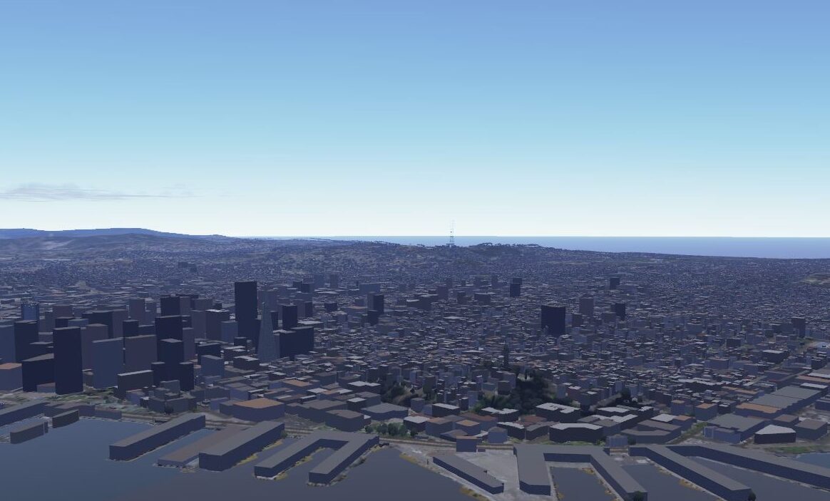
An early version of One World Terrain, the Army’s attempt at a 3D digital world map detailed enough for training simulations and mission planning.
WASHINGTON — Maxar Technologies will use open-source geospatial data and multi-source collection techniques, as it continues to develop a prototype of one of the Army’s critical modernization technologies meant to provide a virtual terrain map under a newly awarded contract, the company announced today.
One World Terrain (OWT), a key component of the Army’s Synthetic Training Environment (STE), aims to deliver a realistic global 3D map of terrain for soldiers to use when training for current and future combat missions. Army Futures Command’s STE cross-functional team has been tasked with developing the capability along with other critical modernization initiatives like the IVAS-Squad Immersive Virtual Trainer and Reconfigurable Virtual Collective Trainer.
Under phase “3B” of the contract, “Maxar will focus on enhanced conflation with open-source geospatial data and enhanced training areas using multisource collection, high-resolution insets,” according to a Maxar press release. “The OWT prototype will evaluate the use of small unmanned aerial collections and the georegistration of existing U.S. Army terrain datasets.”
Georegistration meshes satellite imagery with geographical coordinates and landmarks to provide locational context that provides the necessary context to the visual. The technique is key to speeding satellite imagery review and analysis, both by humans and machine learning software.
“The evolution of OWT shows how 3D terrain and information services are becoming essential tools for planning and decision-making not just for the U.S. Army but for a wide range of military, civil and commercial institutions,” Tony Frazier, Maxar’s executive vice president and general manager of public sector earth intelligence, said in the company’s announcement.
In phase 3A of the contract, the company worked on “improving 3D terrain dataset fidelity and refining the automation processes to generate realistic terrain derived from Maxar’s satellite imagery for high-fidelity modeling and simulation systems, as well as terrain data export capability for operational Mission Command Information Systems,” the announcement added.
OWT is one of 24 technologies Army Chief of Staff Gen. James McConville promised to deliver prototypes of by this year, National Defense Magazine reported. The service has already used OWT in the initial experimentation studies of its medium and light robotic combat vehicles.
The original $35.8 million Phase 1 OWT contract was awarded in June 2019 to Vricon, which was acquired by Maxar the following year. The company was awarded a $39.3 million Phase 2 contract in February 2021. The Phase 3B contract announcement did not include how much the contract was worth, but Maxar has previously said the total value of the prototype project would be $94.7 million if all three phases were completed.
Army eyes TBI monitoring, wearable tech for soldiers in high-risk billets
“We are also looking at what additional personal protective equipment we can provide to our folks, especially instructors and others who are routinely exposed to blast pressure,” said Army Secretary Christine Wormuth.
