AUSA 2022 — The Army is seeking industry input to help it figure out how best to deploy intelligence, surveillance and reconnaissance payloads on very high altitude drones, said Mark Kitz, the service’s lead buyer of such technology.
The focus is on “programs at high altitude above 60,000 feet and how we can get after stratospheric sensing technologies, and then how we build sensor technologies that are resilient to this future environment,” Kitz, Army program executive officer for intelligence, electronic warfare and sensors, said Monday at the Association of the US Army’s (AUSA) annual conference in Washington, D.C. “We have a lot of investments in building resilience and technology.”
In particular, he added, this involves navigation warfare, assured positioning, navigation and timing (PNT) and “our ability to have trusted space and trusted sensors in our future.”
To get there, Kitz said, the Army is “challenging industry” to help.
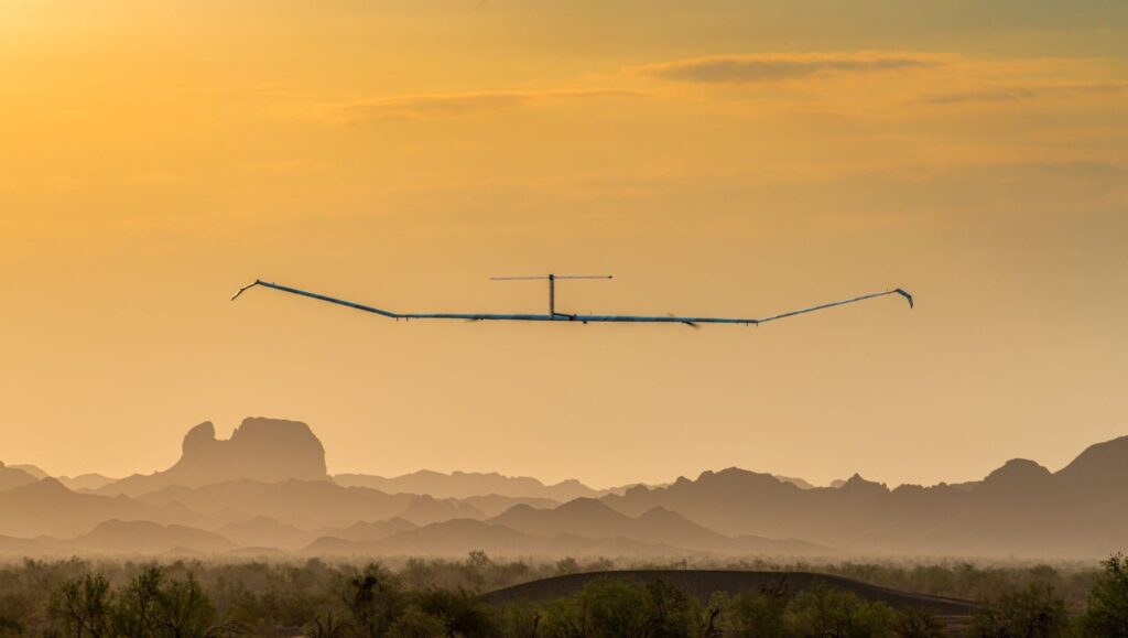
His call for outside ideas comes in the wake of the rather ignominious end of the service’s last high altitude drone test in August — when the ultra-endurance drone known as the Zephyr was left to languish in the sky for weeks until brought down by what the Army called an “unexpected termination of [its] flight.” As a result, the next test of the spindly Zephyr, made by Airbus US, has been delayed until sometime next year.
Michael Monteleone, director of the Army’s assured PNT and space cross functional team, told the AUSA panel that the service is interested in high altitude platforms as a capability for “bridging between an aerial layer and space.”
In particular, he added, his shop is “very interested of thoughts on payload capabilities, regardless of platform, but payload capabilities that might be multi-function.”
High-altitude drones are one key layer in the Army’s “multi-layered sensing strategy,” explained Lt. Gen. Laura Potter, Army deputy chief of staff for intelligence (G2) told the AUSA panel.
“Our strategy has three layers and a foundation: the space layer, optimizing what we can get from government or commercial things on orbit; an aerial layer that includes manned and unmanned platforms from the stratosphere to the mid- to high-altitude layer that is optimized with sensors for a high-end adversary to the ground layer; and the terrestrial layer where we need sensing at echelon,” she said.
Those layers are underpinned by a foundational layer for data transport at “every classification level,” Potter added. “It has to have the right analytics so that from the point of that sensor on the edge all the way back to that young man or woman under incredible amount of pressure to deliver intelligence at speed, that those soldiers are optimized to deliver the intelligence they need for commanders at echelon. And that is no small task.”
AUSA 2022

![]()