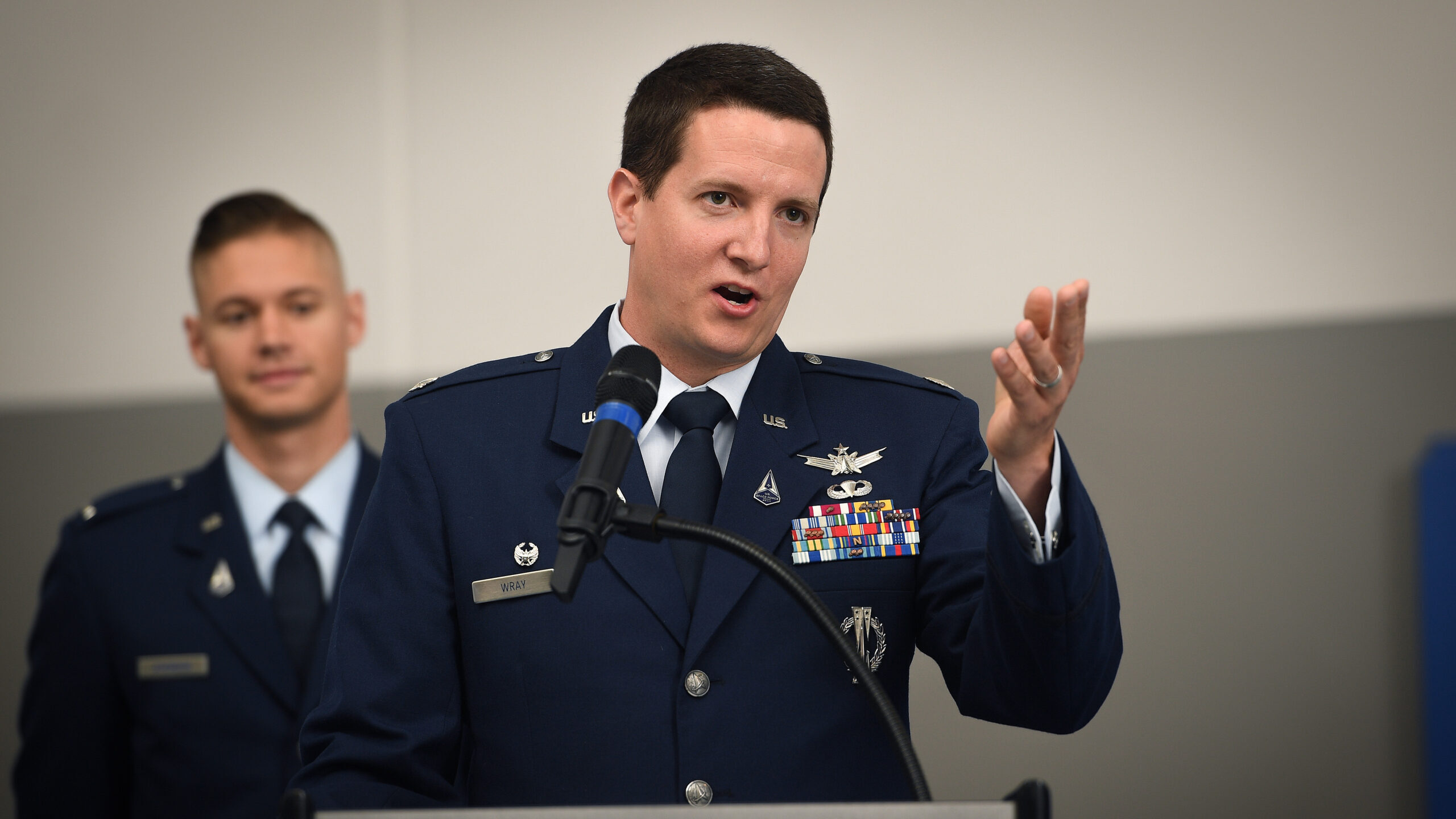
USSF Lt Col Robert Wray speaks at the 2nd Space Operations Squadron 2 (SOPS) change of command ceremony at Schriever SFB, Colorado 6 July, 2022. (U.S. Space Force Photo by Dennis Rogers)
SCHRIEVER SFB — The Defense Department is inviting seven of the closest US allies — the members of the Five Eyes intelligence coalition, plus France, Germany and Japan — to participate in operations of GPS satellites by assigning their own military personnel to serve alongside the Space Force’s 2nd Space Operations Squadron, according to the squadron’s commander.
“We’ll be offering this as an opportunity to those nations’ personnel,” Lt. Col. Robert Wray told reporters April 21 on a rare tour of the GPS ops floor here.
With the US, the Five Eyes allies are Australia, Canada, New Zealand and the United Kingdom.
Wray explained that those countries have been involved for a number of years in the US military’s Schriever Wargames, which exercise space conflict scenarios, and that the invitation to join in GPS ops kicks this long-standing cooperation up a notch. (All seven of the countries participated in the most recent Schriever games, which ended March 31.)
“Now, we’re gonna operate with the largest space system in DoD at that level. So I think it’d be a great opportunity, a great partnership. I know I’ve had many opportunities to do coalition work in my career at different places around the world, and I always learn so much from our coalition partners,” he said. Prior to his assignment to lead the GPS operations squadron in July 2022, Wray served as the military advisor for space policy at the State Department.
When allied personnel might actually be on the floor at Schriever, he said, depends on whether the nations invited want to take up the offer, and if so, how long it might take them to organize assignments.
Globe-Spanning Operations, 24/7/365
Cape Canaveral Space Force Station, Fla. (50th Space Wing archives.)
Wray’s 2nd Space Operations Squadron (SOPS), part of Space Force’s Delta 8, provides command and control of the 38 Global Positioning System positioning, timing and navigation (PNT) satellites on orbit — 31 active, one test and six spares.
Besides their primary sensors for PNT missions, GPS satellites also carry a secondary Nuclear Detection System payload for detecting electromagnetic signals caused by a nuclear blast. The various GPS models (updated versions have been launched over time) broadcast several different signals, some open to the public airwaves and some reserved for military operations.
The squadron comprises 124 active duty personnel, of which 62 are officers, 50 enlisted and 12 civilians, located here at the GPS “master control station” (MCS), according to charts provided by Wray’s shop. There is also a “backup” control station, essentially a “duplicate” of the MCS, at Vandenberg SFB in California, Wray explained, crewed by reserves at 19th SOPS.
The 2nd SOPS manages a globe-spanning network of computerized monitoring stations and ground control antennas for the GPS satellites, both for day-to-day operations and for troubleshooting problems.
The ground stations and their large antennas, Wray said, are based at: Cape Canaveral, Florida; Ascension Island in the Atlantic Ocean; Diego Garcia in the Indian Ocean; and Kwajalein Atoll in the Marshall Islands in the Pacific Ocean.
“So, from those four locations, we can see any one of our satellites at the same time and we can control any of our satellites as needed,” he said.
The monitoring stations track the satellites’ navigation signals and relay the information to the MCS, which continuously processes the data, determines each satellite’s precise location, and updates the satellites’ navigation messages through the ground antennas, according to a Space Force fact sheet.
Wray explained that the purpose of the monitoring equipment is to “make sure that what we’re transmitting is 100 percent accurate. If there is any deviation caused by … whatever it might be, and we notice our timing’s off by billionths of seconds, we can go and upload a more accurate time to ensure that the signal is as accurate as possible.”
Wray noted with pride that keeping GPS not only working but also accurate is a no-fail mission, and one that the US military successfully has been undertaking for more than four decades — with the 50th anniversary of the GPS program’s initiation coming up in December.
“One of the key things that we highlight is our commitment to integrity. GPS has never gone offline. GPS has never failed. GPS has never transmitted inaccurate navigation solutions to users. A bad day might be that a solution, instead of being half a meter off, is 0.6 meters off from your real location,” he said.
 Timing: The Most Important Mission
Wray explained that the most important mission for GPS is not what most people think of — i.e. positioning, and/or detection of nuclear detonations — but actually timing. The timing function, via the highly precise atomic clocks carried on the satellites, is critical for example to scheduling aircraft landings, and the functioning of major US dams.
A number of things outside of deliberate interference (read: jamming) can cause anomalies in GPS signals, he said, such as solar weather, perturbations in the atmosphere, or simply the rotation of the Earth, since it is not a perfect sphere. In fact, Wray noted, most interference detected is not due to jamming, but other natural or unintended human-made causes.
There are 16 GPS monitoring stations around the world, according to the squadron’s charts, and a 17th being built near Perth, Australia.
“There’s one on top of this building … [and] on every continent except for Antarctica. And from the stations, I might not be talking to every satellite at the same time, but I’m watching every satellite at the same time. And that is global presence,” Wray said, adding that there is a “10-member crew on duty 24/7/ 365 days a year” at the Schriever MCS.
Those 10 crew, from both the Space Force and Air Force, further are all quite young, fresh-faced and earnest. A number of them actually are on their first space duty assignment, Wray noted. And while each has gone through “a long pipeline of training,” he said the team’s collective youth and lack of experience — especially compared to satellite operations staff in the civil world who tend to be experts with many years notched on their belts — can be a challenge.
Highlighting this point is the fact that most of the crew stations are equipped with more computer monitors than people — each screen filled with rows of data, colored bar charts, and the like.
“Our crews are very technically smart, very technically capable. But again, experience comes with time,” he said.
Finding And Fixing Disruptions
Wray’s shop also is home to the GPS Warfighter Collaboration Cell, a 24/7 help center for military, civilian and commercial users of GPS systems in the event of disruptions or other problems.
“We do have a military mission and military users, not just us, but coalition and allied military users, who need support,” Wray said.
Not only does the two-person crew manning the cell respond to calls for assistance, he added, they can also help advise military users planning missions on what routes to take to avoid GPS jamming. They further can work with US and allied commanders to ensure that for certain missions where GPS signals are hard to reliably receive, such as in mountainous areas or jungles, or where there is GPS interference to pump up the broadcasting power levels on the military-only signal to ensure connectivity.
“If there’s terrain features, dense foliage, we can optimize GPS to enable users there to have the best quality signal to find a precision location and we’ll optimize GPS for that part of the world for the duration of the operation,” he said.
While the military missions are the priority for the Space Force, Wray explained that the bulk of GPS users are civilians — “I would say 99 percent” — both domestically and internationally. Thus, the collaboration cell works most often with civilian agencies around the world.
At home, the cell interfaces with agencies such as the Federal Aviation Administration, the Coast Guard’s navigation centers, and the Department of Homeland Security to analyze and fix GPS disruptions — such as a 33-hour-long outage in at Denver International Airport in January 2022 that mangled air traffic for days, caused by what ultimately was found to be a transmitter error [PDF]. (The exact source was never publicly identified.)
The 2nd SOPS actually has “the Space Force’s only homeland defense mission,” Wray said. “GPS … can be jammed. No surprise there. But if it happens domestically, all the different users who rely on GPS, we want to mitigate that as quickly as possible.
“And so we are the Department of Defense delegate — which is interesting at a squadron level pretty far away from Washington — we represent the whole Department of Defense whenever there’s a jamming event. And it might be unintentional, it might be natural, it might be hostile, it might be non-hostile, there are many different ways where this could present itself.”
The GPS program and its operators, Wray said, in many ways exemplifies the Space Force’s multifaceted mission, which touches military and civil users at home and abroad, in peacetime and in conflict.
“We call ourselves the face of space,” he summed up.
China stirred the Pacific pot, Japan powered up and Aussie AUKUS anxiety emerged: 2024 in review
The Chinese military itself wasn’t free from drama, as Beijing cycled through defense ministers and senior officials fell under investigation.
