
WASHINGTON: Traditionally, satellite ground stations have been the national security space’s stepchildren, unfairly unloved, underfunded and late.
Satellites often launch and reach orbit years before their ground brethren are ready, making the satellite’s data more difficult to manage and lessening their effectiveness. But Raytheon’s Jane Chappell, who has a track record of delivering the world’s most sophisticated ground stations (MIND) to the master of spy satellites, the NRO, believes really good ground stations could actually mean we need fewer satellites.
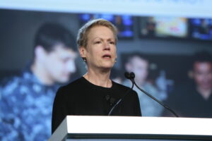
“I will tell you, if you do the ground efficiently, constellations of small sats will be able to take on some of the missions we task the big satellites with today,” said Chappell, vice president of the company’s Global Intelligence Solutions (GIS) mission area.
Why?
Because crunching enormous amounts of data gathered by several small sats could address issues caused by gaps in big satellite coverage. And tasking small sat constellations with “basic” work frees up big satellites to focus on more demanding missions. Also, the use of machine learning to exploit data from previous coverage can help — think supercharged change detection.
The trend has been public for some time.
“We anticipate fielding a ground system able to direct appropriate multi-int collection assets against intelligence problem observables able to redirect assets for digital collection to improve our knowledge and able to learn and adapt, all before any human sees what’s happening,” former NRO director Betty Sapp said almost three years ago. Even then, Sapp said “prototypes are driving operations today” that “move at machine speed to notice the unusual hidden among the host of the unusual.” She said the Sentient prototype was involved. (You’ve got to admire that Sentient came after MIND.)
Robert Cardillo, former NGA director, shed a little more light on Sentient two years ago in an op-ed: “The Sentient program is a research and development effort, conducted jointly with NRO, to experiment with automation that ingests data, makes sense of it in the context of an intelligence problem, and then infers likely future intelligence and collection needs.” Note particularly the use of the word “infer.” According to an NRO briefing for an Industry Advisory Working Group last year, Sentient is now “live,” i.e. operational.
Raytheon, of course, has come up with a term for its broad technology approach to this issue: “sensemaking.” These are automated technologies “that can be integrated into just about any data workflow.” Here are a few examples from Chappell. (As you can tell from her descriptions, much of this leaches across into the classified world. We don’t have a lot of details.)
- A capability that uses Natural Language Processing to free human analysts from manually analyzing transcripts and broadcasts. It notifies them in real-time when key words or topics of interest appear – in 40 written languages, and 16 spoken languages.
- Automated detection of planes and ships in imagery. Deep neural networks scan data and reduce false alarm rates and, the company says, generally outperform traditional methods.
- “A capability that automatically removes structures and trees on bare earth 3D models and improves target location using semantic segmentation.” Translation? Today, an analyst uses metadata to ID every pixel by hand. The new technology allows the system to automatically insert those metadata tags, relying on past characterizations. It can also suggest new tags. “Our automated approach has reduced the time spent manually grooming these models by days and even weeks.”
- Machine learning techniques that allow “automated data discovery” using one-shot and few-shot learning techniques “to improve activity pattern recognition in Multi-INT data.” Basically, that means the technology can discern patterns drawn from optical imagery, infrared, signals intelligence, synthetic aperture radar (SAR) and other data sources.
- “Advanced data labelling techniques that improve activity-based intelligence for aggregation of observed data into activities and events.” Translation: The software can spot events involving more than one element and tell the analyst it’s probably worth looking at more closely.
Much of the technologies above apply not just to spy or larger military satellites but also to the rapidly increasing number of so-called mega constellations, made up of thousands of small satellites.
“Understanding the capabilities of each satellite and managing them as a constellation allows you to take better advantage of those small sats,” Chappell told me. That will allow them “to become a bigger part of the core military and intelligence capabilities.” But don’t expect larger satellites to disappear, Chappell cautions. There’s that whole physics thing, after all. Really good optics require scale. Power supplies are needed for larger sensors. “For the foreseeable future,” she says, “large satellites bring a lot of capability only they can bring.” But expect a great deal more from those ground stations.
Learn more about Raytheon’s space mission solutions here.