WASHINGTON: The Space Force is tacking on plans for replacing its dying weather satellites, looking at a two-pronged acquisitions strategy to cover both near- and far-term needs, a senior Space Systems Command official told Breaking Defense.
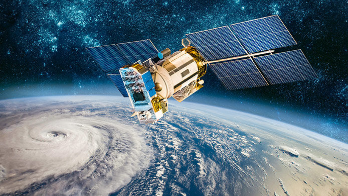
SSC is looking at both buying new satellites to replace those few remaining Defense Meteorological Satellite Program (DMSP) birds, as well as acquiring weather data and analysis as a “service” from commercial vendors, said Lt. Col. Joseph Maguadog, SSC EO/IR Weather System materiel leader. (EO stands for electro-optic and IR for infrared — the two basic types of space-based cameras used in weather monitoring.)
“SSC is exploring both options,” he said in an email, with a focus “on ensuring we meet both the near- & long-term needs of our warfighter.”
“In the near-term, our current vendors are on-track to deliver a system that can provide the necessary EO/IR data to succeed DMSP 17,” Maguadog added. “Long-term, we are continuing to explore options that could provide a more resilient, capable, and affordable architecture.”
The Air Force and Space Force for a few years have been considering the option of buying weather data products rather than building dedicated military satellites.
Weather analytics startup Tomorrow.io in 2019 won its first Small Business Innovation Research (SBIR) contract from the Air Force to explore its software for potential use by Air Force Special Operations Command.

Why enterprise IT modernization matters now – and how to “delight by design”
Do more with less: streamline workflows, reduce duplication, invest upfront to save long-term.
In 2020 SpaceX won a contract worth $2 million as part of the Space Force’s Electro-Optical Infrared Weather System (EWS) program, alongside a set of three contracts for prototype satellites (with a total value of $309 million) that went to Raytheon Intelligence & Space (RI&S), General Atomics Electromagnetic Systems (GA-ES) and ASTRA (for Atmospheric & Space Technology Research Associates).
That consideration has now been formalized, with a Jan. 10 Request for Information (RFI) aimed at gathering “preliminary cost and schedule estimates” for “weather data as a service (WxDaaS).”
According to the RFI, “The initial service is expected to begin in FY2025 with options that include improved performance through FY2040.” Interested companies have until Feb. 24 to respond.
“Our previous sensor agnostic efforts with SpaceX revealed the feasibility for a weather data as a service (WxDaaS) model that could meet those long-term objectives. This RFI provides an opportunity for full and open competition if WxDaaS is determined to be a better long-term approach than the traditional model,” Maguadog explained.
The idea is to enter into a contract with a provider that is “kinda like an HBO subscription,” said Shawn Cochran, RI&S associate director for civil and environmental space. And while RI&S has been focused on the prototype competition, he said that is something the company could easily do instead.
In fact, Cochran noted, the prototype satellite building effort also has shifted slightly from a demonstration of capability to replace the entire DMSP constellation (there currently are four on orbit) to focus on rapidly replacing DMSP-17 before it loses functionality.
“Space Force made the decision to pivot from a sort of demonstration of a capability that could be mature to meet the goals of replacing DMSP to a prototype mission for residual operations,” he said. “Essentially it was to replace DMSP-17.”
RI&S, along with GA-ES, late last year both won contracts to provide a prototype satellite capable of “residual operational capability” for three to five years.
At the same time, the service is still looking to down-select one provider sometime this quarter to fulfill all the requirements put together by the Joint Requirements Oversight Council (JROC) for next-generation weather birds, Cochran said.
There are two key needs identified by the JROC, he elaborated: “the science mission” of cloud characterization and theater weather imagery; and the ability to revisit any location on the globe every hour to update the weather picture.
“We were asked to say what would that constellation look like and how would you approach it, and give us a rough order of magnitude on what that would cost?” Cochran said.