
Search results for: digital globe

UPDATED: Adds Details On New Data Partnerships; IC Works With DepSecDef Video Task Force GEOINT: To cope with the gargantuan increase in data sure to come, the National Geospatial Intelligence Agency must broaden its outreach to industry and the civil community, and, at the same time, ensure that it does a better job of ensuring…
By Colin ClarkAI can make logistics data as valuable as intelligence or operational data for mission success
Valuable intelligence insights can be gleaned from logistics or flight-test data when artificial intelligence or machine learning is applied.


WASHINGTON: If you want to grow uneasy about the world, read the US-China Commission’s annual report to Congress. China, while it continues to enjoy robust economic growth, faces a major strategic challenge. Strategically, the biggest threat facing China right now — and the rest of the world given how integrated China is to the global economy…
By Colin Clark
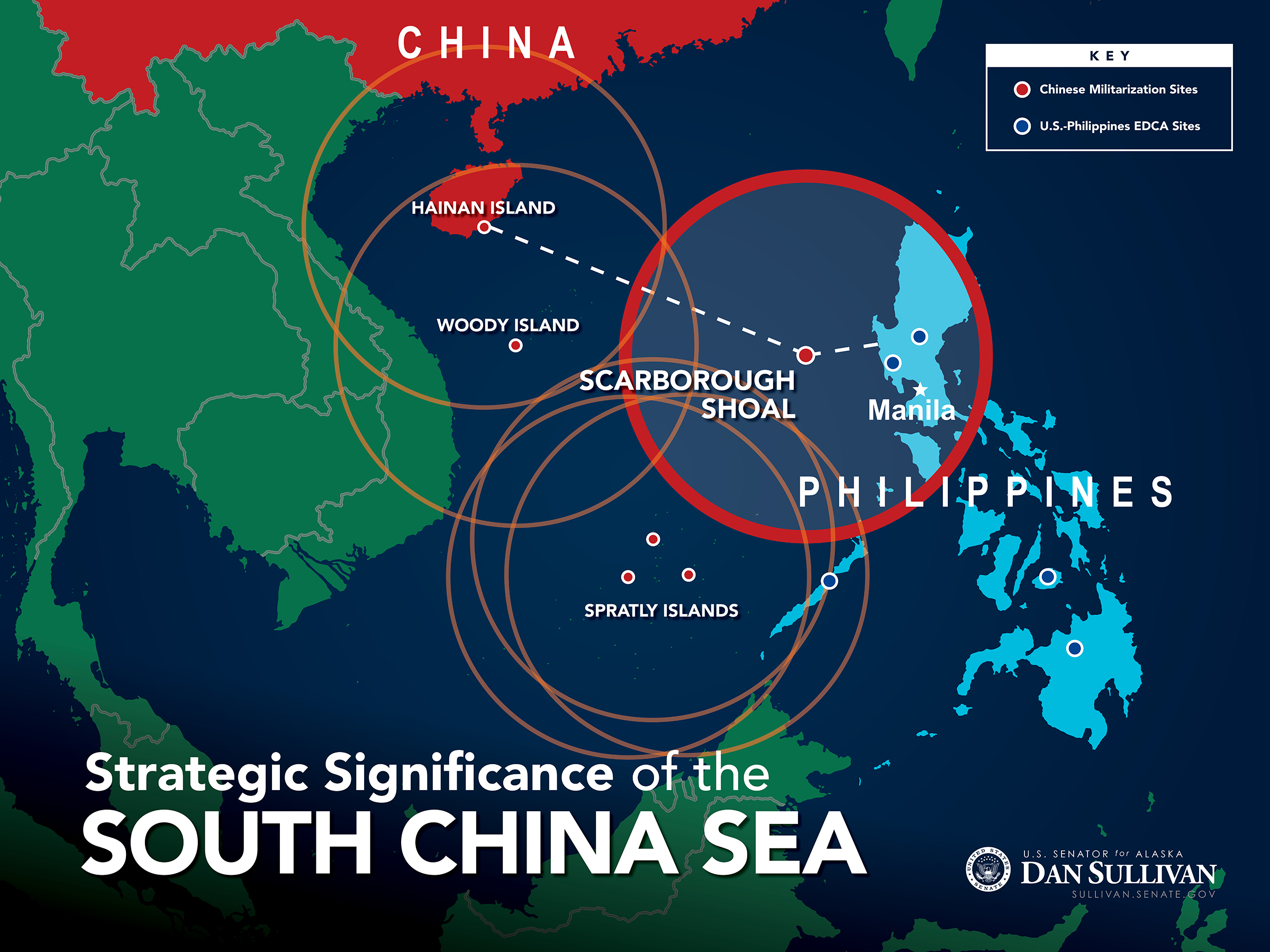
UPDATED with Sen. McCain & Dean Cheng comments WASHINGTON: If China builds an artificial island on the disputed Scarborough Shoal, Sen. Dan Sullivan warned today, it will complete a “strategic triangle” of bases that can dominate the South China Sea. At this morning’s Senate Armed Services Committee hearing, Sullivan displayed a map (above) of the region…
By Sydney J. Freedberg Jr.
WASHINGTON: When President Obama released his new National Security Strategy last week, there was great gnashing of teeth from the GOP over one particular concept mentioned once in the strategy’s 29 pages: strategic patience. Sen. John McCain’s wingman, Lindsey Graham, launched the first strike with a tweet: I doubt ISIL, the Iranian mullahs, or Vladimir…
By Colin ClarkWASHINGTON: There’s no one thing that keeps the Pentagon’s chief of intelligence up at night. There’s half-a-dozen things — terrorism, cybersecurity, Iran, North Korea, Russia, and China — but Mike Vickers has a six-point plan to counter them. “The big challenge we face is really in the aggregation of challenges,” the under secretary for intelligence…
By Sydney J. Freedberg Jr.

When he led NATO, Adm. James Stavridis regularly demonstrated his erudition and insight. We reporters loved talking with him, even if it was at breakfast in a DC hotel. He’s ridiculously over-educated, boasting both a Master of Arts in Law and Diplomacy and a doctorate from Tufts University, where he now leads their Fletcher School. Stavridis often tended…
By James Stavridis and Matthew Daniels
Modernizing military simulation with open systems architecture
Best-of-breed common models and architecture enable virtual training and testing with the same data in a cyber-resilient posture.


Joan Johnson Freese, a member of our Board of Contributors and professor at the Naval War College, is an expert on space, Strategic Command and several other topics dealt with below. She doesn’t think the creation of Cyber Command is a great idea. Read on to find why. The Editor. Analysis of the Peloponnesian War…
By Joan Johnson-Freese
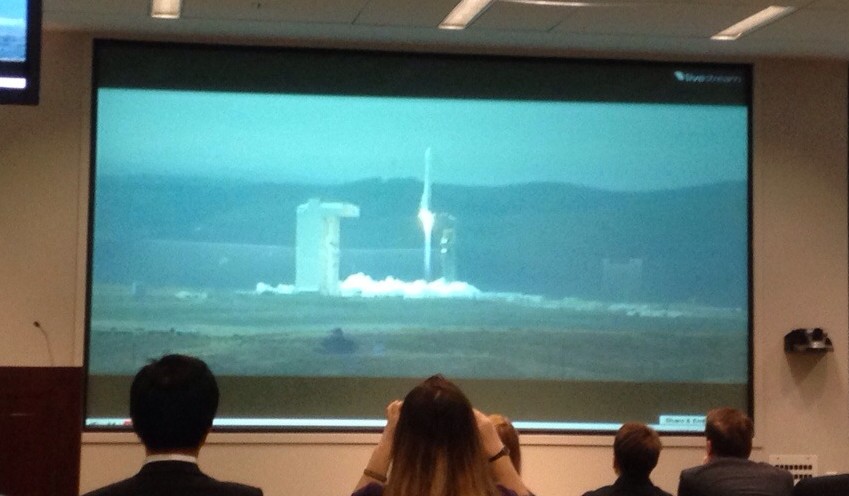
[UPDATED: WorldView-3 launched successfully Wednesday from Vandenberg Air Force Base, California at 11:30 am Pacific time, 2:30 pm Eastern] When DigitalGlobe’s WorldView-3 satellite soars skyward tomorrow – weather permitting – most attention will naturally be on the parts that go up. But the bus-sized imagery collection satellite is just the high-tech tip of an…
By Sydney J. Freedberg Jr.
One does not build military aircraft to fly at air shows. It is fun to see the planes, to visit static displays and to talk with manufacturers and users. But the reality of what a plane can do is only seen in battle and advanced training, where operators, maintainers and leaders in real world combat…
By Robbin Laird

High-tech warfare at knife-fight ranges: that’s the ugly future of urban combat. If you thought Baghdad was bad, with its roughly six million people, imagine a “megacity” of 10 or 20 million, where the slums have more inhabitants than some countries. Imagine a city of the very near future where suspicious locals post every US…
By Sydney J. Freedberg Jr.
TAMPA: The head of the Intelligence Community, Director of National Intelligence James Clapper, told the world’s biggest intelligence conference that he has recommended to the White House that it approve significantly higher resolutions for the nation’s one remaining commercial spy satellite company. Currently, the United States limits the sale of commercial imagery to half a meter. The…
By Colin Clark

WASHINGTON: Positing the future of intelligence — even for one year — poses unique challenges. First, there’s so much those of on the outside don’t know. Then there’s the simple truth that our enemies and competitors drive so much of intelligence. Since we can’t know with certainty what will happen, it’s difficult to predict what the intelligence…
By Colin Clark

AUVSI: Imagine a featherweight aircraft built of composites boasting an enormous 160 foot wing, swathed in solar cells that can take off at 20 mph and remain aloft for five years. Yes, five years. The plane would fly at 65,000 feet, above most air traffic aside from the odd U-2 zooming past. It would, without…
By Colin Clark

Commercial space has many military applications, The National Geospatial Intelligence Agency relies heavily on commercial imagery supplied by DigitalGlobe satellites. The National Reconnaissance Office recently joined with NGA in something called the Commercial GEOINT Activity to buy commercial satellite imagery. A raft of companies are talking about building and operating satellites to provide imagery and other data.…
By Todd Harrison