


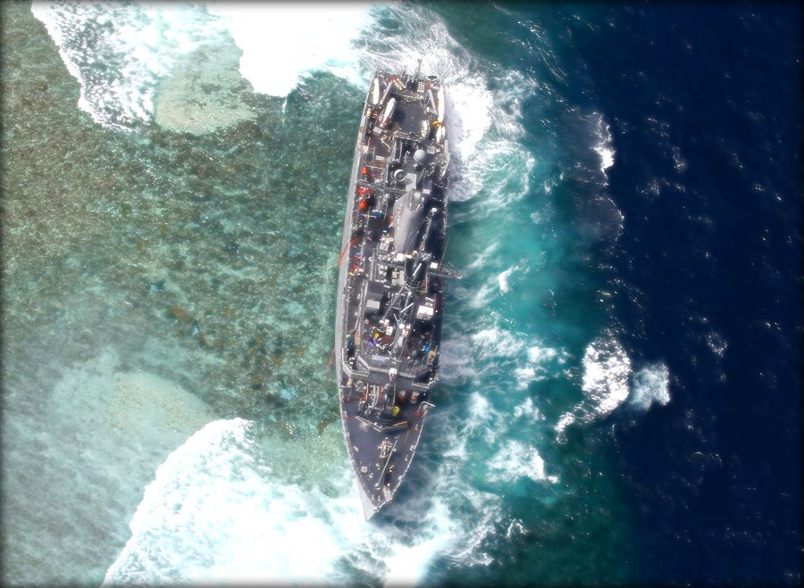
USS Guardian lies crippled on UNESCO World Heritage Tubbataha Reef in the Philippines
WASHINGTON: The January grounding of the minesweeper USS Guardian in a Philippine coral reef was caused in large part by a National Geospatial Intelligence Agency (NGA) map that was, quite simply, wrong by eight nautical miles, Breaking Defense has learned.
“It really was just a terrible fluke that caused the error,” NGA spokeswoman Christine Phillips said in a frank discussion of the incident and its aftermath.
The Sulu Sea grounding prompted NGA to order an agency-wide review of the nautical charts detailing the entire surface of the earth covered by the oceans. Also, NGA and the Navy have convened a team of maritime experts to take “an exhaustive look to make sure we are as sound as we can be,” Phillips told me.

Modernizing our supply chain is a national security imperative
Closing supply chain gaps in innovating technology will reposition the industrial base to be a strategic source of value.
Shipbuilder Austal USA names Michelle Kruger as new president
Kruger had been serving as interim president since former chief Rusty Murdaugh resigned last spring.