WASHINGTON: Russia, China, and Iran can all jam GPS. But what if you could determine your position using a signal, not from a distant satellite, but from your squadmate’s ankle? It wouldn’t have the reach of GPS, but the low-power, short-range transmission would be almost impossible for the enemy to detect.
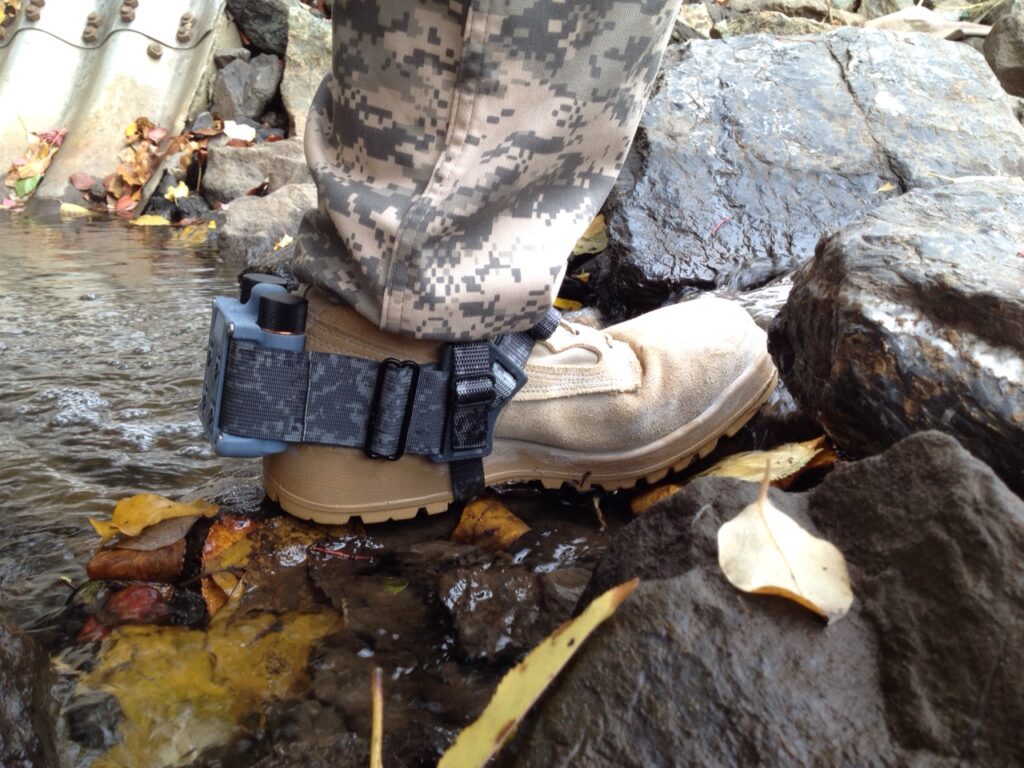
That’s the attraction of the Robotic Research “warfighter localization sensor,” trademarked as WarLoc, which won a $16.5 million Army contract to equip four infantry brigades. The sensor is small enough to strap around the ankle, flush against the back of a combat boot. That makes it a viable option for foot soldiers, in contrast to the heavy-duty anti-jam antennas the Army is mounting on its combat vehicles.
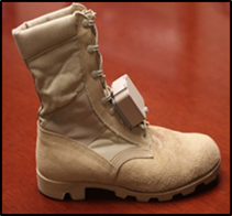
That little WarLoc box contains multiple ways to tell the wearer where they are when GPS goes down, Robotic Research president Alberto Lacaze told me. For starters, it contains several miniaturized Inertial Navigation Systems (INS), which use a combination of accelerometers, gyroscopes, and high-speed computing to figure out when the wearer turns and how fast they’re moving.
But inertial navigation is a fairly old technology, although it keeps get smaller and more precise. The big problem is that it relies on dead reckoning – if I started at X and then moved Y meters in direction Z, I should be here – so errors compound over time, and your real position becomes more and more uncertain the further you go.
So the really cool part of WarLoc is the tiny radio it contains and the ad hoc network those radios automatically create when they detect each other.

How the Pentagon is shaping its next cyber strategy
Drawing on Breaking Defense's TechNet Cyber 2026 coverage, this eBook examines how the Pentagon is advancing AI, cybersecurity, and cyber strategy to strengthen the future force.
See, the Achilles’ heel of GPS is that it’s centralized. If I have a GPS, and you have a GPS, and we can each see the other’s location, our individual devices aren’t communicating directly. My device is talking to the satellite, and your device is talking to the satellite, and the satellite tells each of us, “you’re here, your buddy is there.” Take out the satellite – or just jam our connection, which is way easier – and the individual devices that depend on it go blind.

Many GPS alternatives share the same flaw, Lacaze told me. For example, there are systems for firefighters and other first responders that let the incident commander track the location of their people at a disaster site: That’s great, he said, until you lose your connection to the commander and whatever hub device they’re using. And since urban areas in particular are full of reinforced-concrete buildings, subway tunnels, and basements where radio signals don’t penetrate, losing your connection is all too easy.
WarLoc doesn’t work that way. It’s a distributed system, a democracy of tiny devices. When two devices detect each other, they automatically exchange radio signals to determine the direction and distance between them. This requires multiplying the time it takes to get a return signal by the speed of light, which is about 186,000 miles per second, and then dividing by two to get the distance. If you get your time measurement wrong by a thousandth of a second, your answer will be off by miles, so you need a very, very, very, very precise clock.
But this exchange of ranging signals is just the beginning. Each device also transmits the locations of all the other devices it’s in contact with, and the locations of the devices those devices are in contact with, and the locations of the devices those devices are in contact with, ad infinitum, forming a network.
“All those units are constantly trying to synchronize with the best information they have at the moment,” Lacaze told me. “[Once] communication is established, the system will converge towards the optional locations for the whole team.” If different devices disagree where someone is, they’ll digitally debate the matter and come up with their best estimate, then automatically correct everyone’s displayed position and even their entire history of past movements.
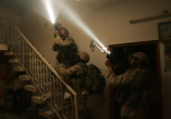
So as soon as your WarLoc device connects to another one, you know the location of everybody connected to that other device, relative to where you are. Now, that’s not the same as knowing your exact latitude and longitude on the surface of the Earth, the way you would with the Global Positioning System. But for foot troops searching a building or clearing a tunnel, what they really need to know is not their global position, but their local position relative to their comrades, so they can coordinate tactics and not accidentally shoot each other. Like politics, all infantry combat is local.
“What’s more important to you is, ‘where’s the location of my buddies?’ – not necessarily, ‘what’s their latitude and longitude,’ but ‘where they are with respect to me’ in my local coordinate frame,” Lacaze said. “The system can work both.”
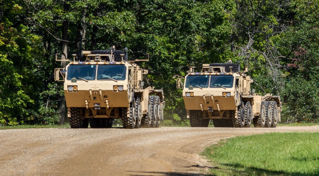
Since each WarLoc contains inertial measurement systems, they can give the users a fairly good idea of where they are relative to some known starting point. And the device can go not only on soldiers, but also on vehicles, on robots – it comes standard on many Robotic Research drones and the Army’s new Leader-Follower self-driving supply trucks – and even in mini-beacons you can drop behind you as you move, like a wireless version of Hansel and Gretel’s breadcrumbs. So as long as any node on the network knows its exact location on the surface of the globe, every connected node can figure out its own position on the map from there. And as long as any node on the network knew its exact location at some point, the inertial measurement systems can give you a pretty accurate estimate of where you ought to be now.
“That’s where the magic sauce of the system is,” Lacaze told me. “It’s not an individual system. It’s a system that is designed to work as a group.”
But, I worried, if all the WarLoc devices are communicating, can’t an adversary detect those signals? That gets very technical and highly classified very quickly, “but this system is not emitting all the time,” Lacaze said. “As a matter of fact, it arguably is not increasing the electromagnetic footprint that the soldier already has with his own radio.” The Army tactical network already requires issuing most soldiers with handheld radios so they can communicate, navigate, and download intelligence data, to which WarLoc only adds “very localized emissions.”
Those signals are very short-ranged and very low-power, Lacaze said: “There’s many other things that the soldier carries that are much easier to detect than this.”
And, of course, if soldiers are really worried about giving away their position, they can always turn their devices off. For all the promise of technology, the Army has increased training on old-school skills with paper map and compass, just in case.