


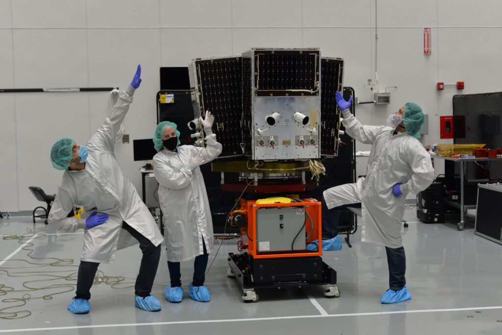
Workers at unconventional remote sensing startup Planet show off its newest high-resolution SkySat.
UPDATED TO ADD LAUNCH DATE FOR NEXT SKYSATS
WASHINGTON: Remote sensing startup Planet has just reconfigured its constellation to keep up with with increasing demand — including from US government agencies — for more rapid satellite revisit rates over ground targets and improved spatial resolution, according to company officials.
“We see the demand, certainly within some of our government customers,” Jim Thomason, VP of Imagery Product at Planet told me in an interview this week. “It seems that, within the US government and elsewhere, there are agencies that want to have more and more access more times a day over the areas that they care about.”
Being able to see multiple images of a target within a short period of time allows customers to ascertain patterns of activity at the target site, he explained. This capability to figure out what is happening over time on the ground is often referred to by the Intelligence Community (IC) as assessing a “pattern of life” and remains something of a holy grail for national security analysts. (Change detection is a related term of art.)
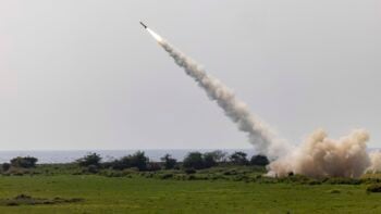
Planet is planning to launch six more of their high-resolution SkySat satellites — originally purchased from Terra Bella in 2017 (which also triggered investment by data giant Google) — bringing the fleet to 21. This, Thomason said, will allow the constellation to take up to 12 images of the same ground target in one day; vice an earlier temporal resolution of twice a day. By comparison, many US spy satellites only have a twice-a-day revisit rate.
UPDATE BEGINS. Indeed, SpaceX just announced that it is planning to launch a Falcon 9 on June 13 carrying three of the Plant SkySats, as well as 58 more Starlink satellites for its expanding broadband constellation. This will be the first launch in SpaceX’s SmallSat Rideshare Program, SpaceX noted. UPDATE ENDS.
“Temporal resolution is really the advantage, in that there’s so much more insight and value to be derived from this more rapid revisit capability,” he explained.
As Breaking D readers know, Planet is one of two (along with BlackSky) up-start remote sensing companies to break into the Intelligence Community market and break up the long-standing monopoly held by Digital Globe, now Maxar Technologies. The company in May 2019 signed a study contract with the National Reconnaissance Office (NRO), and is now in the running for a year-end award for NRO’s planned successor to its current EnhancedView program, contracted to Maxar. (It previously had a study-contract relationship with the National Geospatial-Intelligence Agency prior to its transfer of authority for acquisition of commercial remote sensing to the NRO in 2017.)
“Planet offers global near-daily imagery that is entirely unclassified and our contract with the NRO allows the U.S government to procure satellite imagery for all departments of government,” according to a company statement. “For the past 5 years, we’ve partnered closely with the US government as they’ve leaned into the future vision for augmenting government systems with the cutting-edge earth observation capabilities built by industry.”
The Skysats originally had a spatial resolution of 72 centimeters, vice the medium spatial resolution of Planet’s self-developed Dove satellites, which have a resolution of 3.7 meters. Planet developed the tiny Doves to allow low-cost access to satellite imagery, unconventionally aimed at customers without deep-pockets such as environmental groups and other non-profits. There are currently 130 Doves on-orbit and Planet plans to launch another 26, a spokesperson told me today.
But Thomason explained that Planet’s changes have been driven by a huge increase in demand for higher-resolution pictures — including, somewhat surprisingly, from commercial sectors such as agriculture. Between 2017 and 2018, demand for Planet’s high-resolution imagery jumped a whopping 163 percent, he said.
It is for this reason that the company decided to maneuver the SkySat constellations to lower the orbits of the satellites from their about 500 kilometers above the Earth (in Low Earth Orbit or LEO) to about 450 kilometers, Mike Safyan, VP of Launch, told me.
The move allows the satellites to now provide 50cm imagery — which, although it doesn’t sound like a huge jump, is significant in the remote sensing world.
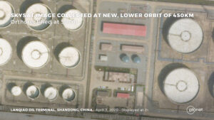
50cm Planet image of an oil terminal in Lanqiao, China
“This 50 centimeter threshold becomes a real differentiator. It’s a well understood benchmark in the industry,” Thomason said.
Safyan explained that while it isn’t that common for an operator to move an entire fleet of satellites to change their performance, instead of just replace them with new satellites in a different configuration, Planet crunched the numbers and found it made more sense.
“In general, we try to ask ourselves questions based on first principles, rather than just blindly following the aerospace textbook,” Safyan said.

Future inevitability of quantum computers is a security problem today
‘Store Now, Decrypt Later’ attacks must be thwarted now with Zero Trust cybersecurity.

Boeing buys GKN factory, ending dispute over F-15, F/A-18 parts
Through the deal, Boeing’s litigation with supplier GKN Aerospace will be dropped, and the aerospace giant will take possession of a St. Louis-area factory it used to own.