WASHINGTON: Speeding information from strategic sources to the battlefield is a key goal as NGA works through how to best support the US military’s evolving approach to All Domain Operations, says Maj. Gen. Charles Cleveland, head of NGA’s Operations Division.
As NGA, like the rest of the US national security establishment, pivots away from counter-terrorism to great power competition, he told the Intelligence National Security Alliance today, leaders are “watching the way of war evolve” as the services figure out “what their future warfighting strategies and capabilities are going to be” and the Joint Staff works to stitch those together in the new Joint Warfighting Concept, due this month.
“What is absolutely common to all of them … [is] long-range sensing and long-range targeting. And each of the services absolutely envisions being able to use national level assets to provide very, very tactical support to their warfighting elements,” Cleveland explained. “So we do think that we’ve got a tremendous role in being able to support the direction that the American military is moving.”
Further, he said, NGA is working to improve its capabilities in the space and cyber realms, because “we now see both of those domains really coming to the forefront and we think at NGA we have a significant role in both of those.”
Ultimately, Cleveland said, to fulfill the agency’s so-called ‘Moonshot Goal’ of being able to hold the strategic capabilities of peer adversaries at risk, NGA has “to accelerate” how it gets information from sensor to decision-makers in order to help the Joint Force “dramatically accelerate their targeting capabilities.”
NGA is looking for ways to improve its “collection orchestration” — how it collects data from various sources, fuses it into operationally useful information and disseminates that information — to better “help synchronize what the broader community is doing to be able to support” warfighters on the battlefield.
Keys to this include improving modeling and accelerating the “tipping and queuing” of the wide array of sensors and data sources operated by DoD, the Intelligence Community, commercial providers and, “to a degree, the open source community,” he said.
At the same time, NGA is working hard to catch the wave of change in remote sensing as commercial and civil capabilities boom, Cleveland said. This includes, as Breaking D readers know, an ongoing initiative to expand its intake of commercial imagery, analytical capabilities and unclassified data by working in partnership with industry. It also includes an effort to rapidly integrate machine learning and artificial intelligence (AI) tools to manage the data influx.
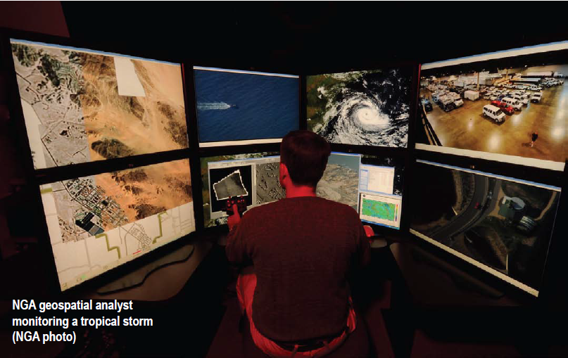
“From a strictly GEOINT standpoint, of course, we do think that we’re in the midst, really of a revolution right now,” he said. “We’re soon moving to a point where we think, essentially, every part of the planet will be imaged on a daily basis.”
NGA has added Planet Federal and BlackSkyGlobal to Maxar as data providers to the Global Enhanced GEOINT Delivery (G-EGD) system, which “provides access to map-ready, unclassified imagery to support a wide range of efforts for the Department of Defense, the intelligence community, federal civilian agencies and over 55 foreign partners,” an NGA announcement said last month.
As Breaking D readers know, NGA re-upped its long-standing contract with Maxar (formerly Digital Globe) for access to the firm’s web-based library of data from its WorldView and GeoEye satellites. “The G-EGD system, first introduced in 2011, consisted of only of imagery from Maxar Technologies, formerly DigitalGlobe. The addition of Planet Federal and BlackSky Global data represents the first time that small satellite imagery has been integrated into the delivery system,” the NGA announcement explained.
In addition, over the past several months NGA has put out new solicitations asking industry about their capabilities to help provide new types of raw data, as well as ways to help analyze it and manage information flow to customers.
These include a Nov. 25 request for information on “persistent change detection” with responses due today. “NGA requires a worldwide dataset identifying persistent changes on or near the surface of the Earth based on remote sensing imagery. NGA intends to use this dataset to provide tipping and cueing for geospatial data enrichment activities, particularly for topographic data and map production. Updated continuously, this near global dataset is primarily delivered through a web service enabled process and in a geodatabase file format upon request,” the RFI says.
Another RFI, which had a response deadline of Dec. 3, is exploring the feasibility of acquiring commercial geolocation data (which uses radio-frequency to pinpoint targets by their emissions). “NGA has an immediate need to discover and monitor emitters of RF energy worldwide, and seeks information on existing capabilities that deliver this data. NGA requires the capability to find and research vessels of interest or other mobile emitters and their historic tracks. In addition, NGA requires the capability to monitor fixed sites related to illicit activity, such as weapon and narcotics trafficking and sanctions violations,” the RFI says.
The RFI followed a successful pilot program in September that examined the viability of using commercial RF data and analytics to support NGA’s intelligence products. The pilot, according to an NGA announcement, used geolocation data provided to the National Reconnaissance Office (NRO) by satellite operator HawkEye 360 under a study contract issued last December. The data was then integrated via NGA’s
Predictive GEOINT Prototype, “which supports an agile development approach for exploring new
commercial sources and analytics that can support NGA’s partners.”
Two more recent RFIs are focused on improving and sustaining NGA’s data management capabilities.
The first is looking to commercial firms to modernize, support sustain GEOINT Data Analytics Cloud, which now needs to be able to handle everything from documents to streaming data. Industry responses were due Dec. 1.
The second seeks contractor assistance for its Orchestration Services Geospatial Intelligence (GEOINT) Reporting (OSGR) Capability “to create, collaborate, publish, and disseminate static and dynamic text-based reporting, interactive content, multi-media content, as well as visual content, across the National System for Geospatial Intelligence (NSG) with minimal duplication of effort and allows reporting to flow seamlessly across all security domains. Industry responses are due Dec. 18.
Finally, NGA launched development and construction of its new “Moonshot Labs” software factory and accelerator in St. Louis in October. It will be a non-profit innovation hub designed to provide a collaborative environment for NGA staff, industry and academia. “What we wanted to do was provide a forum, a space, an area within St Louis … where we could get all of the experts in one area in an unclassified space and be able to explore and partner,” Cleveland said. Construction is expected to be completed in 2021.