What’s in a name: Goodbye Maxar, hello Vantor and Lanteris
Both of the newly named companies are focusing heavily on the national security market for space-related capabilities.
Both of the newly named companies are focusing heavily on the national security market for space-related capabilities.
Maxar has been working on the Army's virtual map program since 2019.

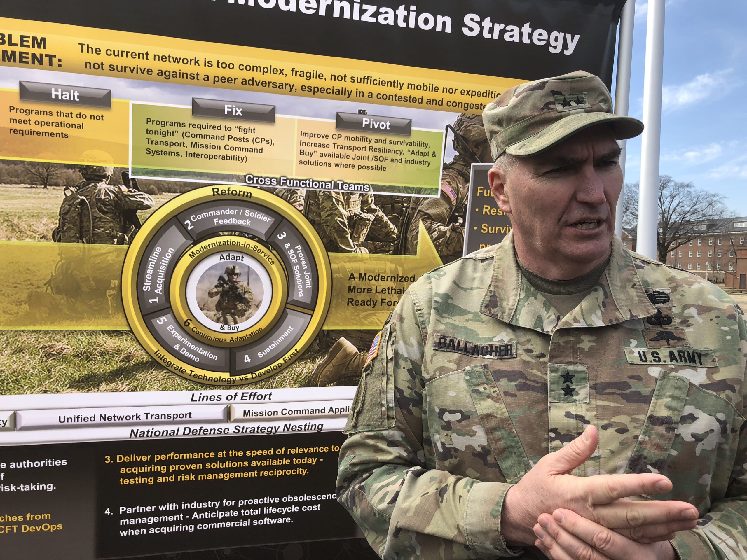
As threats rapidly evolve, digital engineering, manufacturing capacity and robust supply chains are critical to meeting challenges.

"The evolution of OWT shows how 3D terrain and information services are becoming essential tools for planning and decision-making not just for the U.S. Army but for a wide range of military, civil and commercial institutions," Maxar's Tony Frazier said.

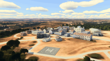
This past fiscal year, the OWT delivered about 2 million square kilometers of 3D datasets to a range of partners, supporting training, operational, and intelligence needs, per the Army.

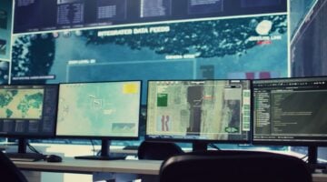
Space-based intelligence for rapid decision-making will be a critical tool in the multiforce, multidomain landscape of the near future.
Brig. Gen. William Glaser, head of the Army's Synthetic Training Environment effort, said his team is "very proud" of One World Terrain because it "really just started off as an idea within the simulations community, but it's expanded out significantly into the operational community."

The Sixth Domain is not defined by geography. It’s a new kind of conflict in which autonomy and networked systems allow thousand-dollar consumer electronics to destroy multi-million-dollar conventional weapons systems.
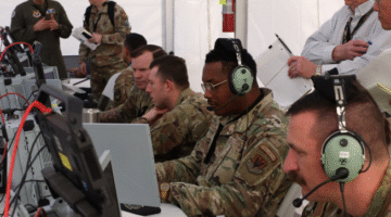
A new training network will simulate the effects of weapons — from mortars and grenades to, potentially, germ warfare — and tell troops if they’re “killed” or “wounded,” then play the whole exercise back for AI analysis. One Army engineer told us: “We’ve never been able to train this stuff, never.”
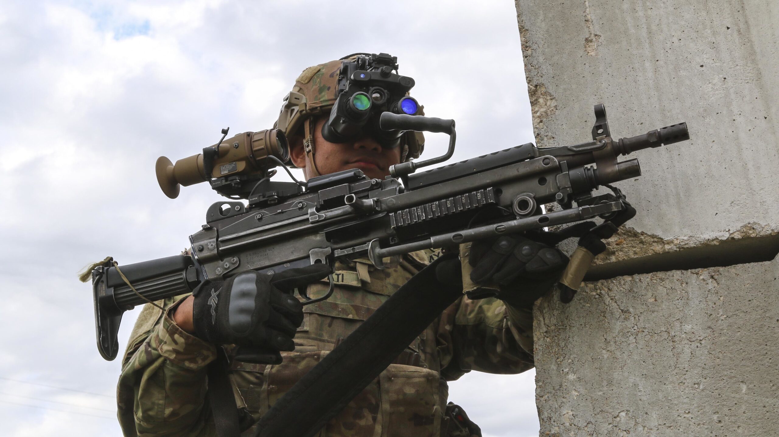
A soldier wearing the ENVG-B can look through binoculars, turn on the camera in their rifle’s sight, and then point that sight around a corner to see and shoot, without exposing anything more than their hands or the rifle.
Gary Blohm, director of the Army Geospatial Center, said 3D is important to troop training and to operational planning because it "helps us navigate, especially when we get to urban environments."

The Army may need to delay the rollout of the new technology, scale it down, or both.
Government can’t stop to update systems, so modernization has to happen without interruptions.
But building a global 3D terrain database will require wrangling huge amounts of data, Maj. Gen. Maria Gervais told us.
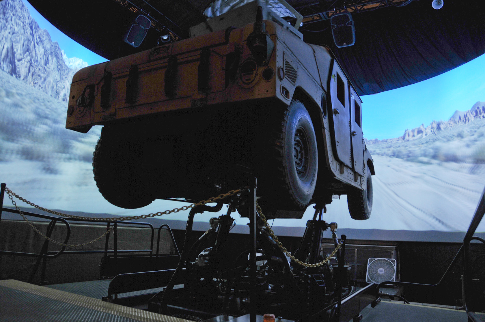
The first phase of the Synthetic Training Environment initiative replaces existing simulators for vehicles. The second phase aims to create — in just two years — something the Army’s never had before: an “immersive” virtual training environment for troops on foot.